

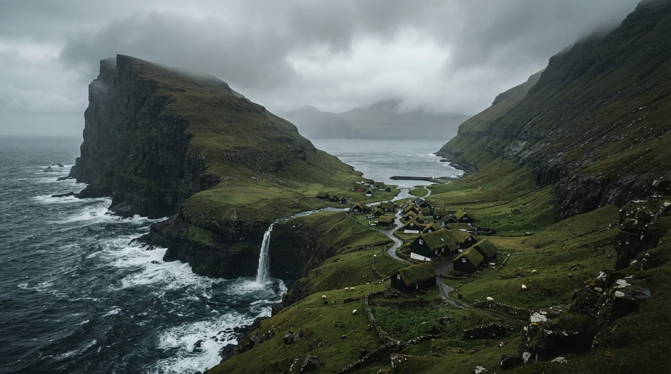
Where on Earth Are the Faroe Islands?
Pinpointing the Faroe Islands on a map requires a deliberate squint. This archipelago of 18 islands sits in the North Atlantic, roughly equidistant between Norway to the east, Iceland to the west, and Scotland to the south. Politically, the Faroes are an autonomous territory within the Kingdom of Denmark, meaning they govern most of their own affairs - including fisheries and taxation - while Denmark handles foreign policy and defense.
The total land area is about 540 square miles, smaller than the state of Rhode Island, yet the islands pack in extraordinary geographic variety. Seventeen of the eighteen islands are inhabited, and the capital, Tórshavn, is home to roughly a third of the archipelago's population of around 55,000 people. For comparison with another dramatic North Atlantic fringe, see how the Faroes differ from the Scottish Highlands - a similarly wild but distinctly continental European setting.
18
Islands in the archipelago
17 of the 18 Faroe Islands are inhabited, connected by tunnels, bridges, and ferry routes.
~55,000
Total population of the Faroes
According to Statistics Faroe Islands, roughly one-third of residents live in the capital, Tórshavn.
~2,000 ft
Height of Enniberg sea cliffs
The cliffs on the island of Viðoy are considered among the highest vertical sea cliffs on Earth.
The Landscape: Cliffs, Waterfalls, and Endless Green
Few places on the planet deliver geological drama quite so relentlessly. The Faroe Islands were formed by volcanic activity approximately 55-60 million years ago, and the evidence is everywhere: basalt columns, layered cliff faces, and sea stacks that drop hundreds of feet straight into churning Atlantic waters. The cliffs at Enniberg, on the island of Viðoy, are among the highest vertical sea cliffs in the world, plunging roughly 2,000 feet from plateau to ocean.
Freshwater lakes perch at impossible-seeming heights - Sørvágsvatn (also called Leitisvatn) is famous for the optical illusion that makes it appear to float above the ocean below. Waterfalls cascade off cliff edges with no beach to break their fall; on windy days, they blow sideways before reaching the water. The interiors are carpeted in a vivid green that photographers chase for hours, punctuated by the iconic turf-roofed farmhouses that have insulated Faroese families against the elements for centuries.
Download offline maps before you go - mobile coverage drops out in tunnels and on remote plateaus, and navigation apps that rely on live data can leave you stranded mid-hike.
The Faroes' sub-sea tunnels and elevated interior plateaus create genuine dead zones for standard mobile data; offline mapping is standard practice among experienced island visitors.
Pack waterproof layers you can add or remove quickly - a dry morning can become a sideways-rain afternoon within the hour, and the best viewpoints rarely have shelter nearby.
The islands' subpolar oceanic climate produces rapid, unpredictable weather shifts; experienced travellers treat layering as non-negotiable rather than optional.
Faroese Culture and Daily Life
Faroese identity is hard-won and deeply felt. The language - Faroese, a North Germanic tongue descended from Old Norse - was standardised only in the 20th century after centuries of Danish dominance, and its survival is a point of enormous cultural pride. You'll hear it everywhere, though English is widely spoken, especially among younger residents.
The sea is the gravitational center of Faroese life. Fishing accounts for a significant share of the economy, and traditional knowledge of tides, currents, and weather is passed between generations as practical necessity, not nostalgia. Music, textile crafts, and rowing competitions (kapprógv) are central to community identity. The Faroese chain dance - performed at major festivals without instruments, voices carrying medieval ballads - is a living tradition unlike anything you'll encounter elsewhere in Europe.
“The Faroese have maintained their language, their music, and their relationship with the sea through centuries of isolation and outside pressure. That continuity is not stubbornness - it is identity.”
— Jóannes Patursson, Historical Faroese home-rule advocate and cultural figure (1866-1946), widely cited in Faroese cultural history
Climate and When to Visit
The Faroes experience what meteorologists call a subpolar oceanic climate: cool temperatures year-round, high precipitation, and wind that rarely takes a day off. Average summer temperatures hover around 50-57°F (10-14°C); winters rarely drop far below freezing thanks to the moderating influence of the Atlantic. That said, conditions can shift dramatically within a single afternoon - locals joke that you can experience all four seasons before lunch.
Best Window for Hiking and Daylight
June and July offer the longest days - dusk doesn't fully arrive until well past 10 p.m. near the solstice. This extended light gives hikers flexibility to tackle longer coastal routes without rushing. That said, always check trail conditions locally before setting out; some high routes are only accessible in summer months.
Summer (June through August) offers the longest daylight hours and the most accessible hiking conditions, though even then waterproofs are non-negotiable. Winter travel rewards visitors with dramatic storms, the possibility of northern lights, and far fewer crowds - but many coastal trails are dangerous or closed. Spring and early autumn sit in a comfortable middle ground: fewer visitors than peak summer, moody atmospheric light beloved by photographers, and reasonable trail access.
Getting There and Getting Around
Most international visitors arrive by air at Vágar Airport, the islands' sole airport. Direct or connecting flights operate from Copenhagen, Reykjavík, and several other European cities; journey times from the US east coast typically involve a single connection in Europe. An alternative - and memorably scenic - option is the Smyril Line ferry, which sails from Hirtshals in Denmark and Seyðisfjörður in Iceland, calling at Tórshavn. The crossing from Denmark takes roughly two days and is a journey in itself.
Once on the islands, a remarkable infrastructure knits everything together. Sub-sea road tunnels - including the Eysturoyartunnilin, an underwater roundabout that opened in 2020 - connect islands that once required ferry crossings. Inter-island ferries still serve several routes. Renting a car gives the most flexibility for independent exploration, though roads can be narrow, sheep are a genuine road hazard, and mountain tunnels are sometimes single-lane. For travellers who enjoy comparing dramatic island topography, New Zealand's approach to diverse island geography offers an interesting parallel on a much larger scale.
Watch for Sheep on Roads and Trails
Free-roaming sheep are everywhere on the Faroe Islands - on roads, cliff paths, and even near tunnel entrances. Drive carefully, especially on single-lane mountain roads where animals appear without warning. On trails, be aware that sheep paths can look deceptively like marked hiking routes and sometimes lead toward exposed cliff edges.
What Makes the Faroes Worth the Journey
The Faroe Islands don't seduce visitors with warm beaches or easy luxury. What they offer is something rarer: a feeling of genuine remoteness that is increasingly hard to find in an over-documented world, paired with an infrastructure that's quietly modern and traveller-friendly. Tórshavn has a compact, walkable capital with restaurants elevating locally sourced seafood and lamb. Hiking trails cross plateaus where the only sound is wind and puffins. The light - when the mist breaks - has a quality that landscape photographers describe as unmatched.
The islands also reward curiosity. Every village has a history, every cliff a legend, and the Faroese are generally warm hosts who appreciate visitors who arrive with genuine interest rather than checklist tourism. The Faroes aren't the easiest destination to reach, but for travellers who value singular landscapes, living culture, and the particular satisfaction of arriving somewhere that genuinely feels like the edge of the world - the journey is very much the point.
Visit Faroe Islands (Official Tourism Site)
The official destination guide covers trail maps, seasonal conditions, ferry schedules, and practical entry information directly from local authorities.
Faroe Islands Hiking Trail Database
An interactive trail map maintained by local tourism authorities, showing difficulty ratings, estimated times, and current seasonal accessibility for routes across all major islands.
Smyril Line Ferry Planner
For travellers considering the scenic ferry crossing from Denmark or Iceland, the operator's site outlines routes, crossing times, and cabin options - a memorable alternative to flying.
The content provided on our blog site traverses numerous categories, offering readers valuable and practical information. Readers can use the editorial team’s research and data to gain more insights into their topics of interest. However, they are requested not to treat the articles as conclusive. The website team cannot be held responsible for differences in data or inaccuracies found across other platforms. Please also note that the site might also miss out on various schemes and offers available that the readers may find more beneficial than the ones we cover.